


-
- About the District
- Administration
-
Local Government
district Council
-
তথ্য প্রদানকারী কর্মকর্তার তথ্য
-
নোটিশ বোর্ড
-
e-Tender Notice
-
প্রধান নির্বাহী কর্মকর্তার প্রোফাইল
-
ঠিকাদারী লাইসেন্স নবায়ন বিজ্ঞপ্তি ২০২০-২০২১
-
District Council Office
-
Officers/employers of the District council
-
Compulsory functions of the district council
-
Dakbangalow
-
Progress Report
-
Communucation
-
citizen charter
-
Budget Summary 2019-2020
-
Chairman of the former District Council
-
Administrator\'s message
-
organizational structure
-
তথ্য প্রদানকারী কর্মকর্তার তথ্য
-
Govt. Offices
Agriculture & Food
-
District Food Office
-
Department Of Agriculture Extension.
-
District Livestock Office.
-
District marketing Office.
-
District Fishery Office
-
BADC (Seed)
-
District Seed Certification Agency Office
-
District Cotton Development Board Office
-
Bangladesh Food Safety Authority, District Office, Meherpur
-
badc (mi)
Engineering and ICT
-
LGED
-
Education Engineering Department
-
Department of Public Health Engineering
-
BTCL
-
Meherpur Electric Supply, WZPDCL, Meherpur
-
Meherpur Palli Bidyut Samity
-
Industrial Assistant Center
-
Meherpur Head Post Office
-
Public Works Department.
-
Road and Highways Department.
-
District Relief and Rehabilitation Office
-
DoICT, Meherpur
-
Bangladesh Water Development Board, Meherpur
About Human Resources Development
-
Islamic Foundation
-
Bangladesh Rural Development Board.
-
District Co-operative Office
-
District Women Affairs Office
-
District Social Welfare Office.
-
District Youth Development Office
-
Urban Social Services Office, Meherpur
-
Disability Service and Support Center, Meherpur
-
Meherpur Technical Training Center
-
District Hindu Religious Welfare Trust Officw
-
Integrated Visually Impaired Education Program, Meherpur
-
District Food Office
- Others Institute
- Photo Gallery
- e-Services
-
-
-
About the District
District Contact
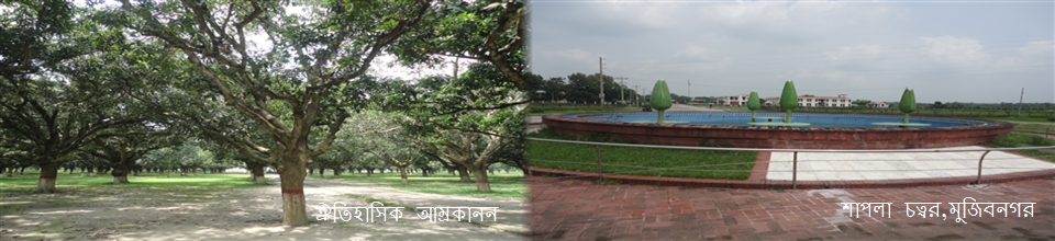
History and Tradition
Geographical and Economic
-
Administration
Deputy Commissioner.
Deputy Commissioner\'s Office
DDLG/Additional District Commissioners
Officers and Employees
Branch related
Important Information
-
Local Government
Meherpur Pourashava
Formation of Municipality
Activities of the Municipality
district Council
- তথ্য প্রদানকারী কর্মকর্তার তথ্য
- নোটিশ বোর্ড
- e-Tender Notice
- প্রধান নির্বাহী কর্মকর্তার প্রোফাইল
- ঠিকাদারী লাইসেন্স নবায়ন বিজ্ঞপ্তি ২০২০-২০২১
- District Council Office
- Officers/employers of the District council
- Compulsory functions of the district council
- Dakbangalow
- Progress Report
- Communucation
- citizen charter
- Budget Summary 2019-2020
- Chairman of the former District Council
- Administrator\'s message
- organizational structure
LGSP-2
-
Govt. Offices
Law-discipline and security issues
Education & culture
Agriculture & Food
- District Food Office
- Department Of Agriculture Extension.
- District Livestock Office.
- District marketing Office.
- District Fishery Office
- BADC (Seed)
- District Seed Certification Agency Office
- District Cotton Development Board Office
- Bangladesh Food Safety Authority, District Office, Meherpur
- badc (mi)
Engineering and ICT
- LGED
- Education Engineering Department
- Department of Public Health Engineering
- BTCL
- Meherpur Electric Supply, WZPDCL, Meherpur
- Meherpur Palli Bidyut Samity
- Industrial Assistant Center
- Meherpur Head Post Office
- Public Works Department.
- Road and Highways Department.
- District Relief and Rehabilitation Office
- DoICT, Meherpur
- Bangladesh Water Development Board, Meherpur
About Human Resources Development
- Islamic Foundation
- Bangladesh Rural Development Board.
- District Co-operative Office
- District Women Affairs Office
- District Social Welfare Office.
- District Youth Development Office
- Urban Social Services Office, Meherpur
- Disability Service and Support Center, Meherpur
- Meherpur Technical Training Center
- District Hindu Religious Welfare Trust Officw
- Integrated Visually Impaired Education Program, Meherpur
About the Health
Land & Revenue
-
Others Institute
Education
Organization
Non Govt. Institute
ধর্মীয় প্রতিষ্ঠান
-
Photo Gallery
Photo Gallery
Video Gallery
-
e-Services
National E-Service
Union Information & Service Center.
-
Location:
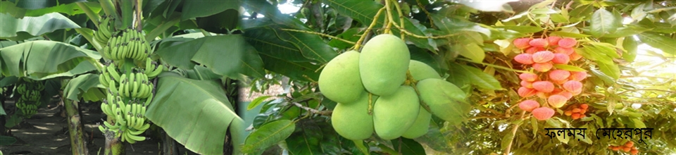
Volume 716.08 sq km It is the border district of the western part of Bangladesh. Kushtia District and West Bengal (India), Chuadanga and West Bengal (India) on the south, Chuadanga and Kushtia districts on the east, West Bengal (India) on the west.
Earth Nature:
Meherpur district's entire land area is almost depleted. The water in this area flows very little water. The rainy season also does not flow like flooded water. As a result, there is no scope for new sediment storage. However, the direction of the river spiral was created in Meherpur, due to many bullocks (Ox bow Lake).
Total area of Meherpur - 716.08 sq km.
Upazila based area is as follows:
Meherpur Sadar - 261.42 sq km.
Gangni - 341.98 square kilometers.
Mujibnagar - 112.68 sq km
Size Percentage Rate
Meherpur Sadar - 36.51%
Ganges - 47.76%
Mujibnagar - 15.73%
Population - 6,55,392
Male - 3,24,634
Female - 3,30,758
Annual population growth rate = 1.02%


Planning and Implementation: Cabinet Division, A2I, BCC, DoICT and BASIS
Technical Assistance:
![]()
Developed By:
